For more than 60 years, the United States has had two definitions of the foot to measure length. One is the US survey foot, which dates to 1893 and is expressed as a fraction: 1200/3937 meters, or 0.3048006096… meters. The other is the slightly shorter and more exact international foot—0.3048 meters—which was adopted in 1959.
This all changed on December 31, 2022, when the National Institute of Standards and Technology (NIST) and the National Oceanic and Atmospheric Administration (NOAA) officially deprecated the US survey foot.
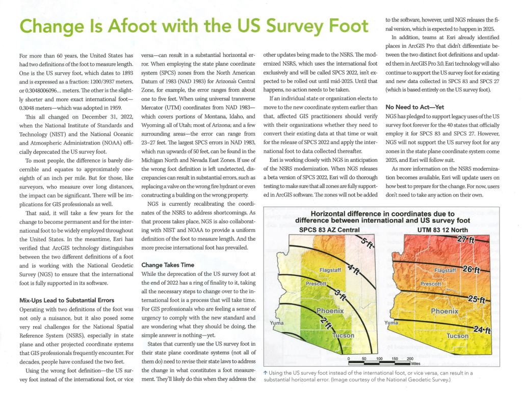
To most people, the difference is barely discernible and equates to approximately one-eighth of an inch per mile. But for those, like surveyors, who measure over long distances, the impact can be significant. There will be implications for GIS professionals as well.
That said, it will take a few years for the change to become permanent and for the international foot to be widely employed throughout the United States. In the meantime, Esri has verified that ArcGIS technology distinguishes between the two different definitions of a foot and is working with the National Geodetic Survey (NGS) to ensure that the international foot is fully supported in its software.
From esri – Full Article Here